| ← Back | Next Falls → |
Twin Creek Falls, Arthur's PassWaterfall Seasons - The Waterfall Guide
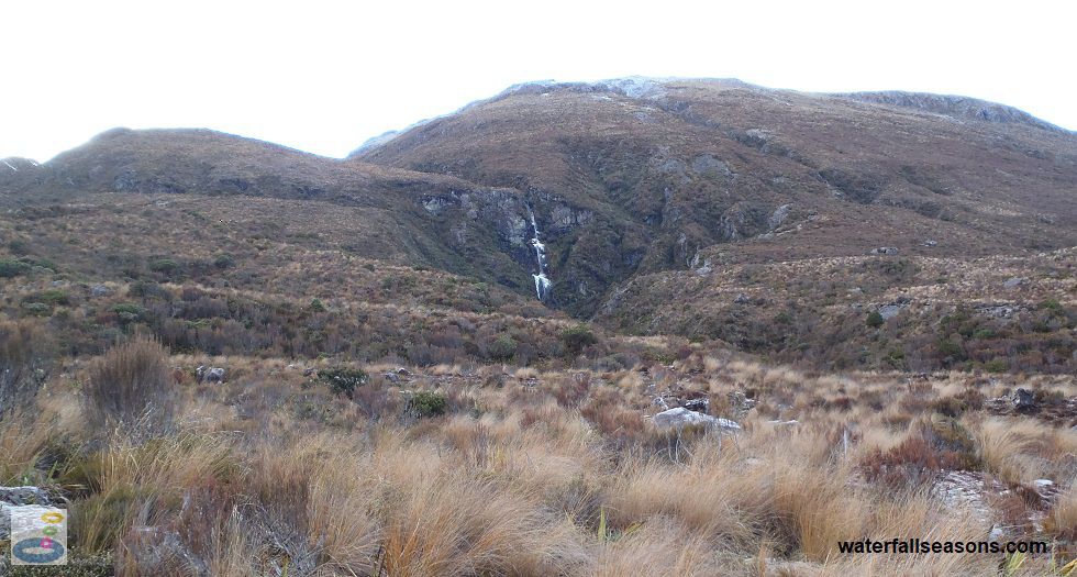
Visible from the highway, Twin Creek Falls near Arthur's Pass is a short walk from the Temple
Basin Track Car Park, across the rocky, open valley floor. At over 110 metres in height and with only scrubby
vegetation around, the falls stand out in the landscape.
 Above: Twin Creek Falls from the Temple Basin Track car park
(Order this image)
I visited in winter, and was unable to traverse very far along the Temple Basin Track towards the falls due to icy conditions.
The track has mid-sized boulders that move around under your feet, so try and bring a pair of walking boots with ankle support. There is
no official walking track to the falls, but the Temple Basin Track takes you up beside the falls. If anyone has managed to get closer
to the falls than I did, let me know via the comment form below.
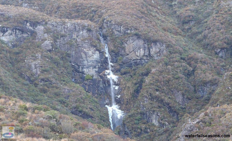
 Above: Twin Creek Falls squeezing through the rock in winter
(Order this image)
View Larger Map
 Above: Twin Creek Falls from the Temple Basin Track car park
(Order this image)
I visited in winter, and was unable to traverse very far along the Temple Basin Track towards the falls due to icy conditions.
 Above: Twin Creek Falls squeezing through the rock in winter
(Order this image)
Your Seasonal Guide:
| Best Time of Year to Visit: | Best Time of Day to Visit: |
|---|---|
| Streamflow data is not locally available for this river, but based on available rainfall information, there is likely to be reliable flow over the falls all year round, with flows evenly spread throughout the year. Access is more difficult in winter due to ice on the rocky walking track. | Visit from midday onwards to see the falls in full sun. |
Other Information Before You Go:
Location: Accessible from the Temple Basin Track Car Park, West Coast Road (State Highway 73), Arthur's Pass National Park,
4 km north of Arthur's Pass, 150 km (approx. 2 hour drive) north west of the Christchurch city centre.
Latitude:-42.912190 Longitude:171.565625
Getting there: From Christchurch head along the State Highway 73 through Sheffield and Springfield up to Arthur's Pass. After driving 4 km past Arthur's Pass, the Temple Basin Track Car Park is on the right hand side, next to the road. From the car park, follow the track, which takes you up the hill nearer to the waterfall.
Water source: Twin Creek
Approx. height: 115 metres (source: NZ Dept of Conservation)
Approx. width: 5-10 metres
Approx. length: Near vertical drop
Swimming available at the falls: Unknown
Facilities: Car park at the start of the walking trail. No other facilities, so take your rubbish home with you.
Entrance fee: None
Opening times: Always open
Sun shade: None
Wheelchair access: None
Prohibitions including whether you can bring your dog: No dogs.
Managing authority: NZ Department of Conservation
Nearby attractions: Devil's Punchbowl Falls about 3 km closer to town, and Avalanche Creek Falls in town.
Before you head out, make sure you read the
waterfall safety information and check with the managing authority for any current change of conditions.
Specific to this site, the managing authority warns of icy
conditions in winter, and of the possibility of falling if venturing close to cliff edges.
Latitude:-42.912190 Longitude:171.565625
Getting there: From Christchurch head along the State Highway 73 through Sheffield and Springfield up to Arthur's Pass. After driving 4 km past Arthur's Pass, the Temple Basin Track Car Park is on the right hand side, next to the road. From the car park, follow the track, which takes you up the hill nearer to the waterfall.
Water source: Twin Creek
Approx. height: 115 metres (source: NZ Dept of Conservation)
Approx. width: 5-10 metres
Approx. length: Near vertical drop
Swimming available at the falls: Unknown
Facilities: Car park at the start of the walking trail. No other facilities, so take your rubbish home with you.
Entrance fee: None
Opening times: Always open
Sun shade: None
Wheelchair access: None
Prohibitions including whether you can bring your dog: No dogs.
Managing authority: NZ Department of Conservation
Nearby attractions: Devil's Punchbowl Falls about 3 km closer to town, and Avalanche Creek Falls in town.
Locality Map:
The marker indicates the approximate location of the start of the trail to the falls. If the map is not zoomed in locally, as can occur with some browsers, simply refresh this web page.
View Larger Map
Comments:
If you would like to leave a comment about this waterfall, please fill in the comment box below.
I'm particularly interested in your experiences after visiting, and any changes in conditions, etc.
All fields are required if you would like to see your comments appear on this website.
| ← Back | Next Falls → |
| Home Page | New Zealand |
| Safety Info | Map |
| List of Lists | Your Support |
| Feedback | Media |
|
|
|
|
|
|
|
|
|
|
© Brad Neal 2024. All rights reserved. Here are my
affiliate links and cookies policy and opportunities to provide support to Waterfall Seasons.