| ← Back | Next Falls → |
Cyathea Falls, Tarra Valley VICWaterfall Seasons - The Waterfall Guide
| Australia |
| Victoria |
| Regions of Victoria: |
| Melbourne |
| Nth East VIC |
| Western VIC |
| Gippsland |
| Other Information: |
| Safety Info |
| Map |
| Your Support |
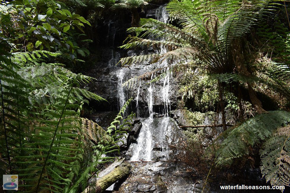
After a short but lush rainforest walk, Cyathea Falls emerges through the ferns, trickling down over rounded boulders before cascading even further below. The view of the falls
can be a little obscured in this deep forest, but the main lace-like threads of water are easily visible from the little seat in front of the falls.
 Above: Cyathea Falls from below in spring
(Order this image)
The relatively gentle, but slightly uphill 500 metre walk to the falls is via a loop track that runs along either side of the creek. It is a wide, open gravel track that is well maintained, with bridges across the creek crossings.
Taking the east track on the way up also takes you past a little cascade at the very base of the falls, just before you start the ascent up to the viewing
platform. The west track is similar in nature, with an abundance of tall, moss-covered tree ferns leaning towards the track.
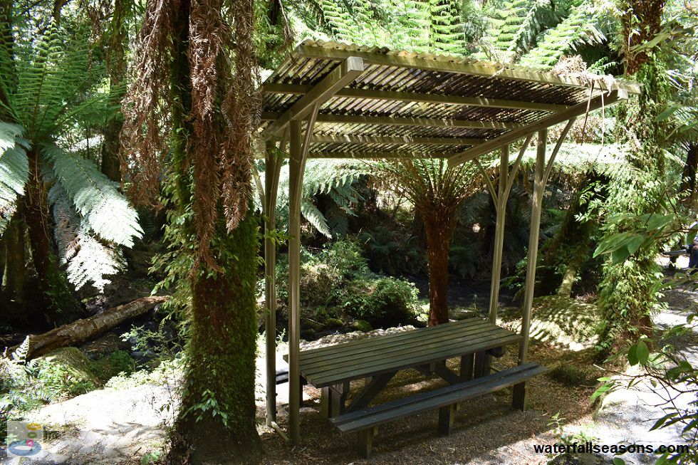
 Above: Cyathea Falls picnic tables
(Order this image)
The picnic tables, located about twenty metres down the steps near the start of the walk, are surrounded by abundant shades of green in a magical fernery. It is so dark under the forest canopy that the picnic tables are covered in laserlite to allow more light through to your picnic spread on the table.
As with any moist, dark forest, do not
forget your mosquito repellent if you are sitting down for a picnic. There are also a couple of larger stone shelters with tin rooves on the edge of the car park for larger groups.
Here is a video of the falls, taken in the early afternoon in early summer, when the creek was flowing steadily:
View Larger Map
 Above: Cyathea Falls from below in spring
(Order this image)
The relatively gentle, but slightly uphill 500 metre walk to the falls is via a loop track that runs along either side of the creek. It is a wide, open gravel track that is well maintained, with bridges across the creek crossings.
 Above: Cyathea Falls picnic tables
(Order this image)
The picnic tables, located about twenty metres down the steps near the start of the walk, are surrounded by abundant shades of green in a magical fernery. It is so dark under the forest canopy that the picnic tables are covered in laserlite to allow more light through to your picnic spread on the table.
Here is a video of the falls, taken in the early afternoon in early summer, when the creek was flowing steadily:
Your Seasonal Guide:
| Best Time of Year to Visit: | Best Time of Day to Visit: |
|---|---|
| It is only a small creek, so visit in winter and spring to see it flowing well | Visit in the afternoon to see the falls in full sun |
Other Information Before You Go:
Location: Tarra Valley Picnic Area, Tarra Valley Road, Tarra Valley, in the Tarra-Bulga National Park, 200 km (approx. 2.5 hr drive) south-east of the Melbourne CBD,
or approximately 40 km south of Traralgon.
Latitude:-38.447730 Longitude:146.538113
Getting there: From Melbourne, head east along the Monash/Princes Freeway (M1) to Traralgon. From Traralgon head south along the Hyland Hwy (C482) then near Loy Yang, continue south along the Traralgon Creek Road (C483) and further south again on Grand Ridge Road (C484) until you reach the Tarra Valley Picnic Area. The falls are a short walk from the picnic area car park.
Water source: Unnamed tribuary of the Tarra River
Approx. height: 30 metres (but most of this is obscured from view)
Approx. width: 3 metres
Approx. length: 100 metres
Swimming available at the falls: No
Facilities: Car park, sheltered picnic tables, public toilet, information boards
Entrance fee: None
Opening times: Always open
Sun shade: Shade available at the falls and the picnic area
Wheelchair access: Wheelchair accessible toilets at the car park. There are wheelchair accessible picnic shelters adjoining the car park. The walk to the falls is not wheelchair accessible.
Prohibitions including whether you can bring your dog: No dogs, no camping, no fires, no horses, no cats, no pets, no generators, no firearms, no fishing
Managing authority: Parks Victoria
Nearby attractions: Tarra Falls, also in the Tarra Valley, 1 km to the south.
Before you head out, make sure you read the
waterfall safety information and check with the managing authority for any current change of conditions. Specific to this site, the
managing authority warns of falling limbs and falling trees, and that some areas around the car park have a slippery surface.
Latitude:-38.447730 Longitude:146.538113
Getting there: From Melbourne, head east along the Monash/Princes Freeway (M1) to Traralgon. From Traralgon head south along the Hyland Hwy (C482) then near Loy Yang, continue south along the Traralgon Creek Road (C483) and further south again on Grand Ridge Road (C484) until you reach the Tarra Valley Picnic Area. The falls are a short walk from the picnic area car park.
Water source: Unnamed tribuary of the Tarra River
Approx. height: 30 metres (but most of this is obscured from view)
Approx. width: 3 metres
Approx. length: 100 metres
Swimming available at the falls: No
Facilities: Car park, sheltered picnic tables, public toilet, information boards
Entrance fee: None
Opening times: Always open
Sun shade: Shade available at the falls and the picnic area
Wheelchair access: Wheelchair accessible toilets at the car park. There are wheelchair accessible picnic shelters adjoining the car park. The walk to the falls is not wheelchair accessible.
Prohibitions including whether you can bring your dog: No dogs, no camping, no fires, no horses, no cats, no pets, no generators, no firearms, no fishing
Managing authority: Parks Victoria
Nearby attractions: Tarra Falls, also in the Tarra Valley, 1 km to the south.
Locality Map:
The marker indicates the approximate location of the car park at the start of the walk to the falls. If the map is not zoomed in locally, as can occur with some browsers, simply refresh this web page.
View Larger Map
Comments:
If you would like to leave a comment about this waterfall, please fill in the comment box below.
I'm particularly interested in your experiences after visiting, and any changes in conditions, etc.
All fields are required if you would like to see your comments appear on this website.
| ← Back | Next Falls → |
| Victoria | Gippsland |
| Safety Info | Map |
| List of Lists | Your Support |
| Feedback | Media |
|
|
|
|
|
|
|
|
|
|
© Brad Neal 2024. All rights reserved. Here are my
affiliate links and cookies policy and opportunities to provide support
to Waterfall Seasons.