| ← Back | Next Falls → |
Lal Lal Falls, BallaratWaterfall Seasons - The Waterfall Guide
| Australia |
| Victoria |
| Regions of Victoria: |
| Melbourne |
| Nth East VIC |
| Western VIC |
| Gippsland |
| Other Information: |
| Safety Info |
| Map |
| Your Support |
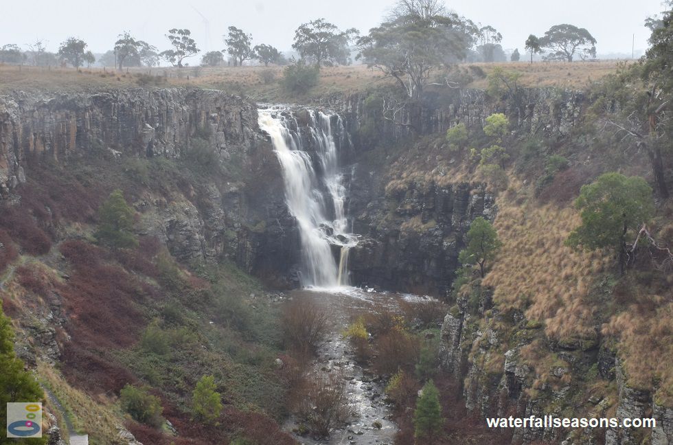
One of best waterfall picnic spots in Victoria, overlooking a 30 metre high basalt column waterfall plunging into a deep ravine near Ballarat. The
area above the falls is an open, grassy plain with plenty of room to run around, a little playground and sheltered barbecue facilities. All of this
is within earshot of the falls, which can pound powerfully down the rockface after rainfall.
 Above: Lal Lal Falls from the viewing platform
(Order this image)
The viewing platform sits on the edge of the wall of the gorge, around 50 metres from the falls, providing an impressive view of the falls. It is also positioned to provide a sweeping view of the gorge as it heads at right angles to the north on its way down to Lal Lal Reservoir.
Beyond the viewing platform there is a further viewing area up on the hill, from which the Austrian painter Eugene von Guerard sketched the falls in 1858, and
after whom the little track to this spot is named. Try your hand at capturing the craggy grey columns of rock, the white fomaing stream, the infamous Ballarat mist,
and the subtle shades of greys, maroons and browns in the shrubbery and grasses that cling to the gorge walls.
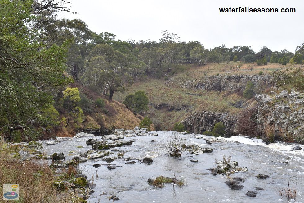
 Above: Above Lal Lal Falls near Ballarat
(Order this image)
You can also view the falls from along the fenceline that runs beside the edge of the cliff, right up to the top of the falls. As if that many viewing angles were not enough, you can also view the falls from the opposite site of the creek, near the start of the Moorabool Falls Trail that is accessible from Harris Road.
In the past you could walk down to the base of the falls as well, but on my visit, access was prohibited by the managing authority.
Here is a video of the falls, taken mid-morning in early winter, when the creek was flowing well after a heavy dump of rain earlier in the week. Apologies for the spots of mist on the camera lens in some scenes, which it proved difficult to avoid when facing the wind.
View Larger Map
 Above: Lal Lal Falls from the viewing platform
(Order this image)
The viewing platform sits on the edge of the wall of the gorge, around 50 metres from the falls, providing an impressive view of the falls. It is also positioned to provide a sweeping view of the gorge as it heads at right angles to the north on its way down to Lal Lal Reservoir.
 Above: Above Lal Lal Falls near Ballarat
(Order this image)
You can also view the falls from along the fenceline that runs beside the edge of the cliff, right up to the top of the falls. As if that many viewing angles were not enough, you can also view the falls from the opposite site of the creek, near the start of the Moorabool Falls Trail that is accessible from Harris Road.
Here is a video of the falls, taken mid-morning in early winter, when the creek was flowing well after a heavy dump of rain earlier in the week. Apologies for the spots of mist on the camera lens in some scenes, which it proved difficult to avoid when facing the wind.
Your Seasonal Guide:
| Best Time of Year to Visit: | Best Time of Day to Visit: |
|---|---|
| Reliable flow in winter/spring. The falls can dry up in summer/autumn. | Early morning is the best time, when soft light shines directly into the gorge, but any time is fine except for late afternoon and dusk, when the falls will be in shadow |
Other Information Before You Go:
Location: Lal Lal Falls Reserve, Lal Lal Falls Road, Lal Lal, 120 km (approx. 90 minute drive) west of the Melbourne CBD.
Latitude:-37.656655 Longitude:144.035336
Getting there: Coming from Melbourne, exit the Western Fwy (M8) at Ballan, head south and then west along the Ballan-Egerton Rd to Egerton. Then continue west along the Yendon-Egerton Rd to Yendon, and then the Yendon-Lal Lal Rd to Lal Lal Falls Rd. There is a car park at the falls.
Water source: Lal Lal Creek
Approx. height: 34 m (sourced from Ian D. Clark's history of Lal Lal Falls Scenic Reserve)
Approx. width: 5-8 m
Approx. length: 5 m
Swimming available at the falls: No
Facilities: Car park, viewing platform, public bbqs, toilets, sheltered picnic tables, lawn area, rubbish bins, kids playground, drinking fountain, information boards, walking track.
Entrance fee: None
Opening times: Always open.
Sun shade: Limited to no shade over most of the picnic area and at the viewing platform. There are some trees near the playground.
Wheelchair access: The gravel paths are reasonably flat, and whilst there are a few steps to the viewing platform, you can still view the falls quite well from the track above the viewing platform. The managing authority designates this site as having disabled access.
Prohibitions: No climbing, no abseiling, no rapelling, no access to the base of the falls.
Managing authority: Moorabool Shire Council
Nearby attractions: Moorabool Falls, also in the Lal Lal Falls Reserve
Before you head out, make sure to read the
waterfall safety information and check with the managing authority for any current change of conditions.
Specific to this site, the managing authority warns to keep clear of cliff edges, take care of the slippery rocks, always supervise children,
and beware of falling tree limbs.
Latitude:-37.656655 Longitude:144.035336
Getting there: Coming from Melbourne, exit the Western Fwy (M8) at Ballan, head south and then west along the Ballan-Egerton Rd to Egerton. Then continue west along the Yendon-Egerton Rd to Yendon, and then the Yendon-Lal Lal Rd to Lal Lal Falls Rd. There is a car park at the falls.
Water source: Lal Lal Creek
Approx. height: 34 m (sourced from Ian D. Clark's history of Lal Lal Falls Scenic Reserve)
Approx. width: 5-8 m
Approx. length: 5 m
Swimming available at the falls: No
Facilities: Car park, viewing platform, public bbqs, toilets, sheltered picnic tables, lawn area, rubbish bins, kids playground, drinking fountain, information boards, walking track.
Entrance fee: None
Opening times: Always open.
Sun shade: Limited to no shade over most of the picnic area and at the viewing platform. There are some trees near the playground.
Wheelchair access: The gravel paths are reasonably flat, and whilst there are a few steps to the viewing platform, you can still view the falls quite well from the track above the viewing platform. The managing authority designates this site as having disabled access.
Prohibitions: No climbing, no abseiling, no rapelling, no access to the base of the falls.
Managing authority: Moorabool Shire Council
Nearby attractions: Moorabool Falls, also in the Lal Lal Falls Reserve
Locality Map:
The marker indicates the location of the car park at the falls. If the map is not zoomed in locally, as can occur with some browsers, simply refresh this web page.
View Larger Map
Comments:
If you would like to leave a comment about this waterfall, please fill in the comment box below.
I'm particularly interested in your experiences after visiting, and any changes in conditions, etc.
All fields are required if you would like to see your comments appear on this website.
| ← Back | Next Falls → |
| Victoria | Western VIC |
| Safety Info | Map |
| List of Lists | Your Support |
| Feedback | Media |
|
|
|
|
|
|
|
|
|
|
© Brad Neal 2024. All rights reserved. Here are my
affiliate links and cookies policy and opportunities to provide support to Waterfall Seasons.