| ← Back | Next Falls → |
Stevensons Falls, VICWaterfall Seasons - The Waterfall Guide
| Australia |
| Victoria |
| Regions of Victoria: |
| Melbourne |
| Nth East VIC |
| Western VIC |
| Gippsland |
| Other Information: |
| Safety Info |
| Map |
| Your Support |
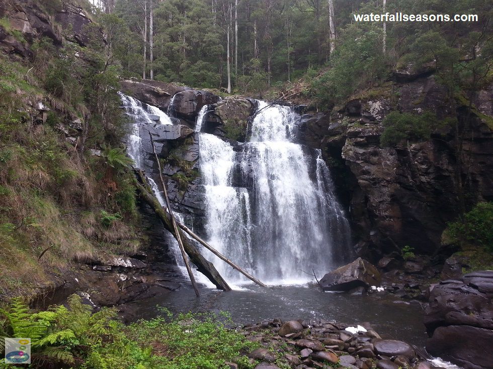
Stevensons Falls is the most powerful, most reliable and most spectacular waterfall in the Otways, located as it is
on one of the largest rivers in the region. There is plenty to like about these falls even before you get there: the crisp, fresh mountain air,
the flat graded, picturesque walking track, the river crossing, and the surreal open field surrounded by giant sequoia trees
on the way in that opens up and then closes down again as you re-enter the rainforest near the falls.
 Above: View of the falls from the river downstream
(Order this image)
When I visited in spring, the air around the falls was extremely moist. Updrafts of wind pick up the spray from the crashing water, which then drifts around on various air currents before settling on the ground or your clothes. If the falls are flowing well, a spray jacket and a cloth for your spectacles or sunglasses is advisable.
The falls themselves are quite high and wide, dumping water ferociously into an upper pool, which then squeezes through a small channel
to a smaller, lower pool and the river downstream.
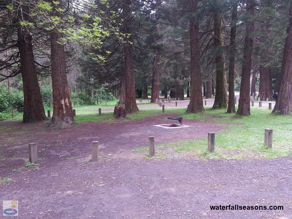
For day visitors, there is a small parking area that is only a 500 metre walk from the falls. The field halfway between the car park and the falls is a lovely spot for a picnic. There is also the Stevensons Falls Campground, which is remote from the falls, 2.3 kilometres downstream on the Gellibrand River. Above: Stevensons Falls campground, 2.3 kilometres downstream of the falls
(Order this image)
There is a walking track that connects the campground to the falls, which includes some river crossings that are impassable at times of high river flow. The campground includes a pit toilet, open fireplaces, and is well shaded by a stand of giant sequoia trees.
At the time of my visit, these unpowered sites were free on a first
come, first served basis. If you are planning to camp on a weekend in summer, have a contingency plan in case it is full. I saw several
anglers fishing in the river next to the campground when I visited.
Here is a video of the falls, taken on a sunny day in November after a relatively wet spring, when the falls were quite loud and flowing well:
View Larger Map
 Above: View of the falls from the river downstream
(Order this image)
When I visited in spring, the air around the falls was extremely moist. Updrafts of wind pick up the spray from the crashing water, which then drifts around on various air currents before settling on the ground or your clothes. If the falls are flowing well, a spray jacket and a cloth for your spectacles or sunglasses is advisable.
For day visitors, there is a small parking area that is only a 500 metre walk from the falls. The field halfway between the car park and the falls is a lovely spot for a picnic. There is also the Stevensons Falls Campground, which is remote from the falls, 2.3 kilometres downstream on the Gellibrand River.
 Above: Stevensons Falls campground, 2.3 kilometres downstream of the falls
(Order this image)
There is a walking track that connects the campground to the falls, which includes some river crossings that are impassable at times of high river flow. The campground includes a pit toilet, open fireplaces, and is well shaded by a stand of giant sequoia trees.
Here is a video of the falls, taken on a sunny day in November after a relatively wet spring, when the falls were quite loud and flowing well:
Your Seasonal Guide:
| Best Time of Year to Visit: | Best Time of Day to Visit: |
|---|---|
| Visit anytime, as the falls are likely to be flowing at all times. Can reduce to a trickle in severe droughts, but has not dried up completely in past drought events. | Visit any time of the day, however in the late afternoon and evening, the falls can be in shadow. |
Other Information Before You Go:
Location: Stevensons Falls Walk, off the Upper Gellibrand Road, near Barramunga,
170 km south west of Melbourne (approx. 2.5 hr drive).
Latitude:-38.571597 Longitude:143.658599
Getting there: From Barramunga, follow the Upper Gellibrand Road for 4.3 km until you reach the campground. Drive across the bridge and follow the signs along the unnamed road to the right for roughly 1 km until you reach the day visitor area. These roads are narrow, winding, dirt roads that were nevertheless accessible by 2WD at the time of my visit. When the Gellibrand River is in flood, the two bridges from the campground to the falls may be impassable. Also note that Google maps has an incorrect location for the falls and does not display the road from the campground to the falls, as at December 2016.
Water source: Gellibrand River
Approx. height: 20-30 m in the main cascade Approx. width: 10-15 m
Approx. length: Near vertical drop
Swimming available at the falls: Yes, but access to the water is difficult due to slippery rocks and blackberries.
Facilities: Car park, picnic tables, lawn (on the walking track). Toilets are available 2.3 km downstream at the Stevensons Falls campground.
Entrance fee: None
Opening times: Always open
Sun shade: Intermittent shade on the walk to the falls. Limited to no shade at the viewing platform.
Wheelchair access: None
Prohibitions: No camping, no fires
Managing authority: Victorian Department of Environment, Land, Water and Planning
Nearby attractions: Marriners Falls, 38 km to the south, inland from Apollo Bay.
Before you head out, make sure to read the
waterfall safety information and check with the managing authority for any current change of conditions.
Latitude:-38.571597 Longitude:143.658599
Getting there: From Barramunga, follow the Upper Gellibrand Road for 4.3 km until you reach the campground. Drive across the bridge and follow the signs along the unnamed road to the right for roughly 1 km until you reach the day visitor area. These roads are narrow, winding, dirt roads that were nevertheless accessible by 2WD at the time of my visit. When the Gellibrand River is in flood, the two bridges from the campground to the falls may be impassable. Also note that Google maps has an incorrect location for the falls and does not display the road from the campground to the falls, as at December 2016.
Water source: Gellibrand River
Approx. height: 20-30 m in the main cascade Approx. width: 10-15 m
Approx. length: Near vertical drop
Swimming available at the falls: Yes, but access to the water is difficult due to slippery rocks and blackberries.
Facilities: Car park, picnic tables, lawn (on the walking track). Toilets are available 2.3 km downstream at the Stevensons Falls campground.
Entrance fee: None
Opening times: Always open
Sun shade: Intermittent shade on the walk to the falls. Limited to no shade at the viewing platform.
Wheelchair access: None
Prohibitions: No camping, no fires
Managing authority: Victorian Department of Environment, Land, Water and Planning
Nearby attractions: Marriners Falls, 38 km to the south, inland from Apollo Bay.
Locality Map:
The marker indicates the location of the car park at the falls. If the map is not zoomed in locally, as can occur with some browsers, simply refresh this web page.
View Larger Map
Comments:
If you would like to leave a comment about this waterfall, please fill in the comment box below.
I'm particularly interested in your experiences after visiting, and any changes in conditions, etc.
All fields are required if you would like to see your comments appear on this website.
| ← Back | Next Falls → |
| Victoria | Western VIC |
| Safety Info | Map |
| List of Lists | Your Support |
| Feedback | Media |
|
|
|
|
|
|
|
|
|
|
© Brad Neal 2024. All rights reserved. Here are my
affiliate links and cookies policy and opportunities to provide support to Waterfall Seasons.