| ← Back | Next Falls → |
Tosha Falls, Alstonville, NSWWaterfall Seasons - The Waterfall Guide
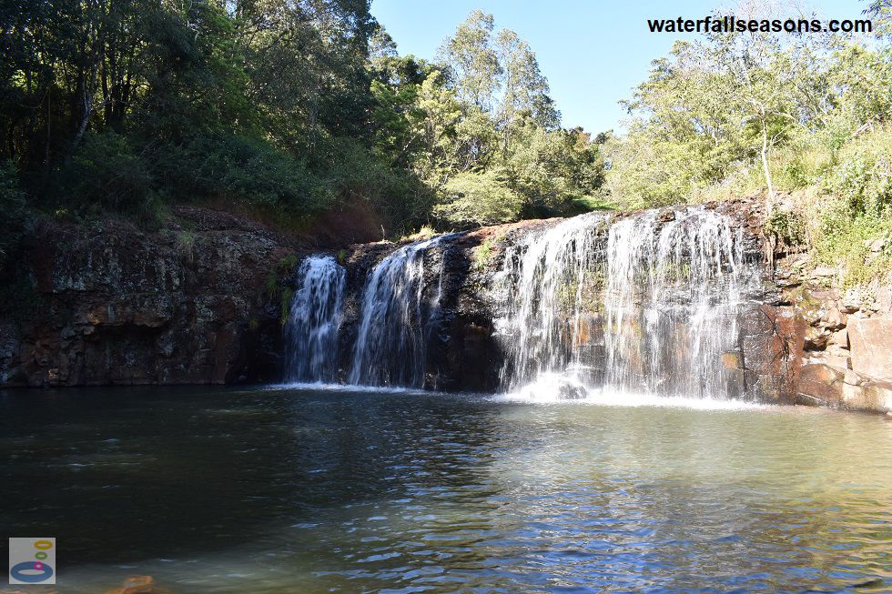
Hidden behind the town's Recycled Water Treatment Plant, Maguires Creek spreads wide across the near-vertical rock face at Tosha Falls into a pool below. It is an unlikely spot for a
waterfall, or an unlikely spot for a Recycled Water Treatment Plant, depending on your viewpoint. The falls are in a pocket of forest with a patchy grass and dirt area in front of the tranquil pool.
 Above: Tosha Falls, half in the morning sun and half in the morning shade
(Order this image)
Can you smell the treatment plant at the falls? The treatment plant lagoons were full when I was there. On a morning with no wind, on my visit there was a faint odour at the parking area, but clean air at the falls. Odour is only likely to be noticeable at the falls when the wind is blowing from the north.
Once you are in the little forested area at the falls, you would not even know that the treatment plant exists.
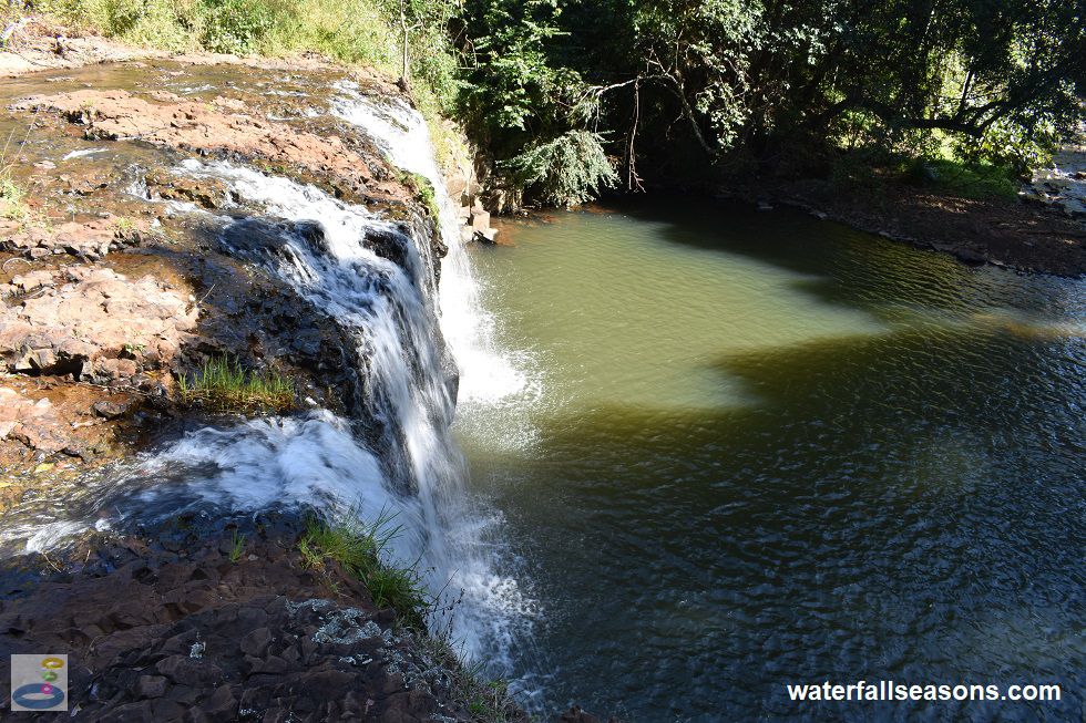
 Above: Tosha Falls from the little track that leads up to the top of the falls
(Order this image)
The shade is good from the surrounding trees, but there are no facilities here, so bring your own mat to rest on if you planning to stay a while. Listening to the steady sound of the falls from the flat area beside the creek downstream would be a good way to spend a lazy afternoon.
Here is a quick video of the falls taken on a dry day in winter when Maguires Creek was flowing mildly, but not in flood. What I most like about this video is that you can see how little water is flowing in the creek under the makeshift bridge.
Despite this, the flow over the falls appears many times larger, because the rocks fan out
the water across the full width of the falls. This could be the waterfall equivalent of a bird puffing out its chest to appear larger than it really is.
View Larger Map
 Above: Tosha Falls, half in the morning sun and half in the morning shade
(Order this image)
Can you smell the treatment plant at the falls? The treatment plant lagoons were full when I was there. On a morning with no wind, on my visit there was a faint odour at the parking area, but clean air at the falls. Odour is only likely to be noticeable at the falls when the wind is blowing from the north.
 Above: Tosha Falls from the little track that leads up to the top of the falls
(Order this image)
The shade is good from the surrounding trees, but there are no facilities here, so bring your own mat to rest on if you planning to stay a while. Listening to the steady sound of the falls from the flat area beside the creek downstream would be a good way to spend a lazy afternoon.
Here is a quick video of the falls taken on a dry day in winter when Maguires Creek was flowing mildly, but not in flood. What I most like about this video is that you can see how little water is flowing in the creek under the makeshift bridge.
Your Seasonal Guide:
| Best Time of Year to Visit: | Best Time of Day to Visit: |
|---|---|
| You can see water flowing over the falls most of the time, with March/April and July/August typically the wettest months. | Visit around midday to see the falls in full sun |
Other Information Before You Go:
Location: Western end of Johnstons Road, Alstonville, 3 km (approx. 5 min drive) north of Alstonville and 730 km (approx. 8 hr drive) north of the Sydney CBD.
Latitude:-28.829824 Longitude:153.445805
Getting there: From the Pacific Highway (M1) exit west just before Ballina onto the Bruxner Hwy (B60). After 5 km, head north onto the Ballina Road and then immediately north again onto Teven Road. Follow Teven Road for 2 km then head west onto Johnstons Road. Follow Johnstons Road to the end, where there are some rock bollards and a handful of parking spaces. From this parking area, walk west and then south along the path beside the treatment plant fenceline for approximately 400 metres until you reach the falls.
Water source: Maguires Creek
Approx. height: 5-10 metres
Approx. width: 10-15 metres
Approx. length: Near-vertical drop
Swimming available at the falls: Yes, noting the managing authority's advice that swimming is not recommended
Facilities: None
Entrance fee: None
Opening times: Always open
Sun shade: Shade available at the car park area and on the shoreline around the pool at the falls.
Wheelchair access: None
Prohibitions: No unauthorised vehicles, no camping or staying overnight, no rubbish dumping, no fires, no motorcycles (outside of the car park), no litter, no golf, no shooting, no alcohol from 10pm to 7am, no trespassing on private property, no entry into the treatment plant. Dogs on leads are permitted.
Accommodation Options: See my accommodation suggestions close to Tosha Falls.
Managing authority: Ballina Shire Council
Nearby attractions: Killen Falls, 13 km to the north-east.
Before you head out, make sure to read the
waterfall safety information and check with the managing authority for any current change of conditions. Specific to this waterfall, the managing authority advises of
submerged rocks, variable water quality - swimming not recommended, strong flowing water, cliffs, deep water, uneven ground, slippery ground and steep ground. The managing authority also advises walkers to
keep to the walking track, avoid native rehabilitation areas and to not trespass on private property.
Latitude:-28.829824 Longitude:153.445805
Getting there: From the Pacific Highway (M1) exit west just before Ballina onto the Bruxner Hwy (B60). After 5 km, head north onto the Ballina Road and then immediately north again onto Teven Road. Follow Teven Road for 2 km then head west onto Johnstons Road. Follow Johnstons Road to the end, where there are some rock bollards and a handful of parking spaces. From this parking area, walk west and then south along the path beside the treatment plant fenceline for approximately 400 metres until you reach the falls.
Water source: Maguires Creek
Approx. height: 5-10 metres
Approx. width: 10-15 metres
Approx. length: Near-vertical drop
Swimming available at the falls: Yes, noting the managing authority's advice that swimming is not recommended
Facilities: None
Entrance fee: None
Opening times: Always open
Sun shade: Shade available at the car park area and on the shoreline around the pool at the falls.
Wheelchair access: None
Prohibitions: No unauthorised vehicles, no camping or staying overnight, no rubbish dumping, no fires, no motorcycles (outside of the car park), no litter, no golf, no shooting, no alcohol from 10pm to 7am, no trespassing on private property, no entry into the treatment plant. Dogs on leads are permitted.
Accommodation Options: See my accommodation suggestions close to Tosha Falls.
Managing authority: Ballina Shire Council
Nearby attractions: Killen Falls, 13 km to the north-east.
Locality Map:
The marker indicates the approximate location of the car parking area at the falls. If the map is not zoomed in locally, as can sometimes occur when loading, simply click or tap on "View Larger Map" below.
View Larger Map
Comments:
If you would like to leave a comment about this waterfall, please fill in the comment box below.
I'm particularly interested in your experiences after visiting, and any changes in conditions, etc.
All fields are required if you would like to see your comments on this website.
| ← Back | Next Falls → |
| Australia | NSW / ACT |
| Safety Info | Map |
| List of Lists | Your Support |
| Feedback | Media |
|
|
|
|
|
|
|
|
|
|
© Brad Neal 2024. All rights reserved. Here are my
affiliate links and cookies policy and opportunities to provide support to Waterfall Seasons.