| ← Back | Next Falls → |
Clamshell FallsWaterfall Seasons - The Waterfall Guide
After a several kilometre walk on an undulating bitumen path, you will find elevated views of this multi-tiered cascade in Behana Gorge, with a waterfall at the top. Conditions
can change dramatically here depending on how much rain has fallen.
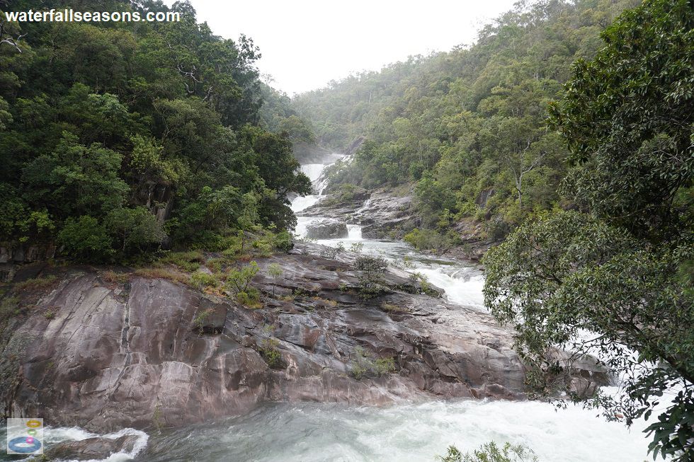
 Above: The cascade roaring at Clamshell Falls
(Order this image)
I visited after a few days of steady rainfall that continued intermittently while walking to the falls. This meant that the cascade below the falls was a raging torrent of white water, but with still a few visible rock outcrops jutting out from the side.
It was still possible to wander out on some of the rock platforms after scrambling down from the path, but quite dangerous near the edge, with a huge standing wave dancing
around menacingly at the downstream end of the top waterfall pool. When conditions are drier, the various pools along the cascade are more clearly defined, with calmer
water moving between them.
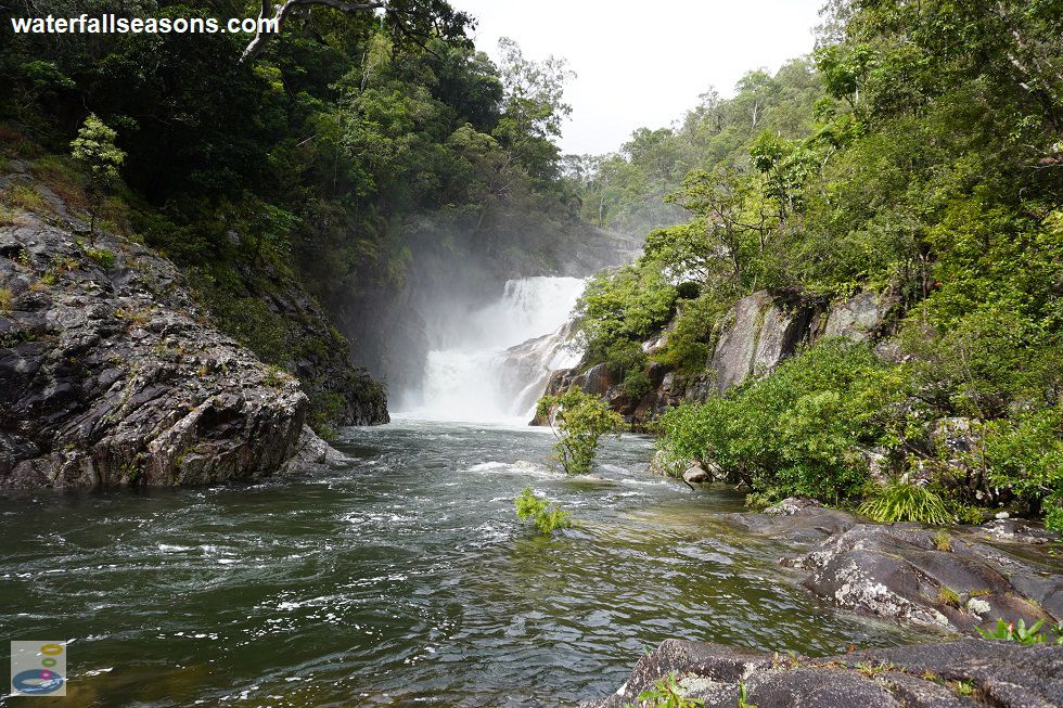
 Above: The main waterfall at Clamshell Falls
(Order this image)
Fortunately, the path to the falls is bitumen, similar to a wide bike path, and is traversable even in the wet. Because of its width, it is well suited to family or social groups who want to have a chat out in nature while exercising, assuming you have enough breath left to talk on some of the steep inclines.
The walk to the outlook point, below the cascade, is 3 km, with a few hundred metres further to reach the main fall at the top of the cascade. The path beyond the top of the falls
is blocked to restrict access to a weir above the falls that is the source of part of Cairns' water supply.
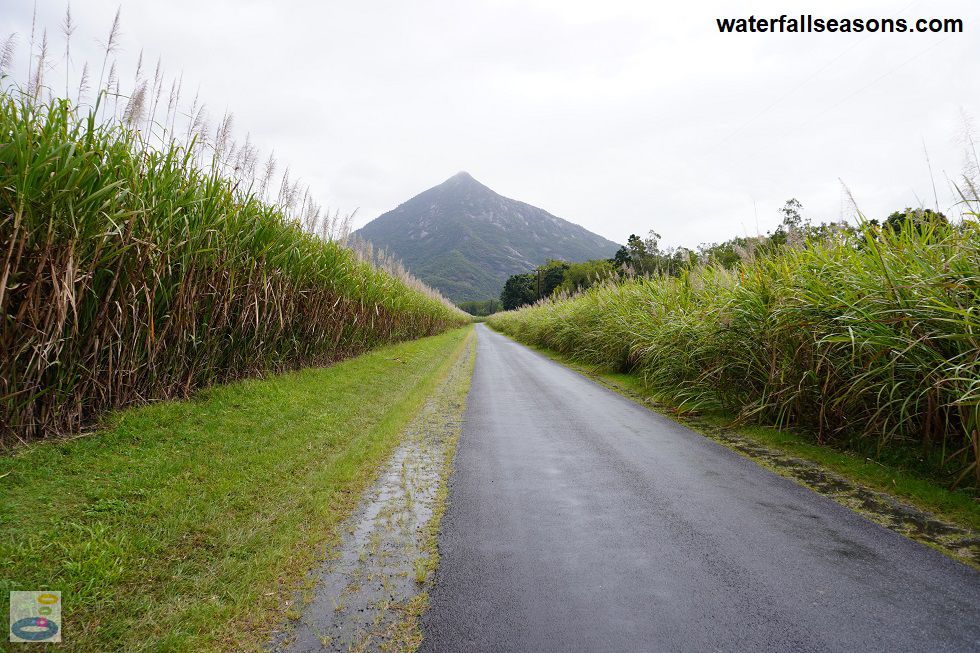
 Above: The road back to Gordonvale from Clamshell Falls
(Order this image)
Clamshell Falls was one of my favourite waterfalls in the region, because the water did not turn brown after heavy rain, like many of the waterfalls on the Atherton Tablelands, because of the pleasant but also mildly challenging walk on a safe, smooth path, and because of the depth of character of the falls, with its various cacades and a stunning waterfall at the top.
View Larger Map
 Above: The cascade roaring at Clamshell Falls
(Order this image)
I visited after a few days of steady rainfall that continued intermittently while walking to the falls. This meant that the cascade below the falls was a raging torrent of white water, but with still a few visible rock outcrops jutting out from the side.
 Above: The main waterfall at Clamshell Falls
(Order this image)
Fortunately, the path to the falls is bitumen, similar to a wide bike path, and is traversable even in the wet. Because of its width, it is well suited to family or social groups who want to have a chat out in nature while exercising, assuming you have enough breath left to talk on some of the steep inclines.
 Above: The road back to Gordonvale from Clamshell Falls
(Order this image)
Clamshell Falls was one of my favourite waterfalls in the region, because the water did not turn brown after heavy rain, like many of the waterfalls on the Atherton Tablelands, because of the pleasant but also mildly challenging walk on a safe, smooth path, and because of the depth of character of the falls, with its various cacades and a stunning waterfall at the top.
Your Seasonal Guide:
| Best Time of Year to Visit: | Best Time of Day to Visit: |
|---|---|
| For rushing water head here on any break in the weather during the wet season, or to see the waterfall pools more clearly defined, come anytime of year | You might want to visit early in the day to avoid a long walk in the heat. The falls are in full sun for most of the day |
Other Information Before You Go:
Location:At the end of Behana Gorge Road, Aloomba, 34 km (approx. 30 minute drive) south of Cairns.
Latitude:-17.189423 Longitude:145.823872
Getting there: From the Bruce Hwy (A1) 6 km south of Gordonvale, follow the Behana Gorge Road to the small car park at the end. From the car park it is a 6 km return walk to the falls.
Water source: Behana Creek
Approx. height: 10 metres at the top falls
Approx. width: 10-30 metres across different sections of the cascade
Approx. length: The cascade is around 300 metres in length
Swimming available at the falls: Yes. Here is more info about my swim
Facilities: Car park
Entrance fee: None
Opening times: Always open
Sun shade: Shade available along most of the track to the falls. Limited to no shade out on the rock shelves at the edge of the water.
Wheelchair access: The path to the falls is wheelchair accessible, but there is a padlock on the access gate, so you might need to contact the managing authority about getting access through the gate. The path to the falls lookout is paved all the way, but very steep in parts. The scramble down to the water is not wheelchair accessible.
Prohibitions including whether you can bring your dog: No littering, no fires, no dogs, no alcohol, no bicycles, no motorbikes, no vehicle access to the walking track, no standing on the pipeline that runs alongside the track.
Managing authority: Cairns Regional Council
Nearby attractions: Babinda Boulders, 41 km to the south by road.
Before you head out, make sure you read the
waterfall safety information and check with the managing authority for any current change of conditions. Specific to this site,
the managing authority warns that there are strong currents, submerged objects, slippery areas, and steep dropoffs in the water, and that children
must be supervised in the water.
Latitude:-17.189423 Longitude:145.823872
Getting there: From the Bruce Hwy (A1) 6 km south of Gordonvale, follow the Behana Gorge Road to the small car park at the end. From the car park it is a 6 km return walk to the falls.
Water source: Behana Creek
Approx. height: 10 metres at the top falls
Approx. width: 10-30 metres across different sections of the cascade
Approx. length: The cascade is around 300 metres in length
Swimming available at the falls: Yes. Here is more info about my swim
Facilities: Car park
Entrance fee: None
Opening times: Always open
Sun shade: Shade available along most of the track to the falls. Limited to no shade out on the rock shelves at the edge of the water.
Wheelchair access: The path to the falls is wheelchair accessible, but there is a padlock on the access gate, so you might need to contact the managing authority about getting access through the gate. The path to the falls lookout is paved all the way, but very steep in parts. The scramble down to the water is not wheelchair accessible.
Prohibitions including whether you can bring your dog: No littering, no fires, no dogs, no alcohol, no bicycles, no motorbikes, no vehicle access to the walking track, no standing on the pipeline that runs alongside the track.
Managing authority: Cairns Regional Council
Nearby attractions: Babinda Boulders, 41 km to the south by road.
Locality Map:
The marker indicates the approximate location of the car park in Behana Gorge Road, at the start of the walk to the falls. If the map is not zoomed in locally,
as can sometimes occur when loading, simply click or tap on "View Larger Map" below.
View Larger Map
Comments:
If you would like to leave a comment about this waterfall, please fill in the comment box below.
I'm particularly interested in your experiences after visiting, and any changes in conditions, etc.
All fields are required if you would like to see your comments appear on this website.
| ← Back | Next Falls → |
| Australia | Queensland |
| Safety Info | Map |
| List of Lists | Your Support |
| Feedback | Media |
|
|
|
|
|
|
|
|
|
|
© Brad Neal 2024. All rights reserved. Here are my
affiliate links and cookies policy and opportunities to provide support to Waterfall Seasons.