| ← Back | Next Falls → |
Eurobin Falls, Mt Buffalo VICWaterfall Seasons - The Waterfall Guide
| Australia |
| Victoria |
| Regions of Victoria: |
| Melbourne |
| Nth East VIC |
| Western VIC |
| Gippsland |
| Other Information: |
| Safety Info |
| Map |
| Your Support |
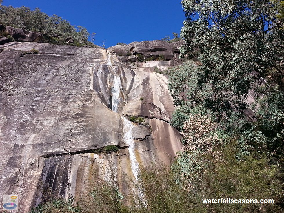
Eurobin Falls consists of sheets of water flowing over the granite rock face of the exposed eastern face of Mount Buffalo. The falls are
divided into an upper and lower section, however in reality it is one continuous geological feature, with a flatter grade on the rock
face between the two steeper sections. The falls are vast in their height and breadth, making it a challenge to photograph in its entirety.
 Above: The view from the base of Upper Eurobin Falls
(Order this image)
It is a fairly mild walk over a gentle hill to reach the lower falls, which you can view from the walking track. The rock is stained with various hues of bronze, orange and grey, as the water splits into various subtly different flow paths. The water clings to the rock face throughout.
The walk to the upper falls is much steeper and contains more steps. The viewing area at the base of the upper falls marks the end of the walking track.
The view from here is much more impressive than the lower falls, as you squint up to the sky to trace Eurobin Creek several hundred metres up the blinding,
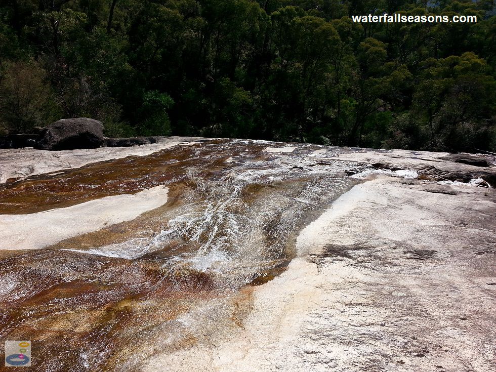
bald rock face. In dry weather, if you take appropriate caution, you can also venture out onto the granite slab in between the upper and lower falls to view
the upper falls from a slightly different angle, and to get a closer view of Eurobin Creek.
 Above: Looking down over Lower Eurobin Falls
(Order this image)
Here is a video of the lower and upper falls, taken shortly before midday in early Autumn, when the falls were flowing after modest rain earlier in the week, but were not in flood:
View Larger Map
 Above: The view from the base of Upper Eurobin Falls
(Order this image)
It is a fairly mild walk over a gentle hill to reach the lower falls, which you can view from the walking track. The rock is stained with various hues of bronze, orange and grey, as the water splits into various subtly different flow paths. The water clings to the rock face throughout.
 Above: Looking down over Lower Eurobin Falls
(Order this image)
Here is a video of the lower and upper falls, taken shortly before midday in early Autumn, when the falls were flowing after modest rain earlier in the week, but were not in flood:
Your Seasonal Guide:
| Best Time of Year to Visit: | Best Time of Day to Visit: |
|---|---|
| The falls can dry up in summer. Visit during the spring snow melt or after rainfall. | Visit from early morning to mid-afternoon to see the falls in full sun. Mount Buffalo will shade the falls in the late afternoon. |
Other Information Before You Go:
Location: Mount Buffalo National Park, Mount Buffalo Road, 320 km (approx. 4 hr drive)
north east of the Melbourne CBD.
Latitude: -36.719612 Longitude: 146.837007
Getting there: From Melbourne take the Hume Fwy (M31) to Snow Road (C522), just past Glenrowan. Head east along Snow Road then south along the Great Alpine Road (B500) to Porepunkah. At the roundabout over the bridge, take the Mount Buffalo Road (C535) towards the National Park. The car park for the falls is roughly 2.5 km from the park entrance, just after the first sharp bend. The walk to the lower falls is 500 metres from the car park, and a further 250 metres to the upper falls.
Water source: Eurobin Creek
Approx. height: Approx. 200 m in total, with most of this drop over the upper falls
Approx. width: Up to 30 m, depending on flow conditions
Approx. length: Approx. 400 m in total length, with around half over the upper falls. The lower falls are approx. 70 m long, with the remaining length being the distance between the falls.
Swimming available at the falls: No
Facilities: A handful of car spaces. No other facilities.
Entrance fee: None
Opening times: Always open
Sun shade: The walking track is partly shaded, but some sections are in full sun.
Wheelchair access: None
Prohibitions: No pets, no bicycles, no horses, no motorbikes, no firearms, take your rubbish home with you.
Managing authority: Parks Victoria
Nearby attractions: Ladies Bath Falls is on the same walking track
Before you head out, make sure to read the
waterfall safety information and check with the managing authority for any current change of conditions.
Latitude: -36.719612 Longitude: 146.837007
Getting there: From Melbourne take the Hume Fwy (M31) to Snow Road (C522), just past Glenrowan. Head east along Snow Road then south along the Great Alpine Road (B500) to Porepunkah. At the roundabout over the bridge, take the Mount Buffalo Road (C535) towards the National Park. The car park for the falls is roughly 2.5 km from the park entrance, just after the first sharp bend. The walk to the lower falls is 500 metres from the car park, and a further 250 metres to the upper falls.
Water source: Eurobin Creek
Approx. height: Approx. 200 m in total, with most of this drop over the upper falls
Approx. width: Up to 30 m, depending on flow conditions
Approx. length: Approx. 400 m in total length, with around half over the upper falls. The lower falls are approx. 70 m long, with the remaining length being the distance between the falls.
Swimming available at the falls: No
Facilities: A handful of car spaces. No other facilities.
Entrance fee: None
Opening times: Always open
Sun shade: The walking track is partly shaded, but some sections are in full sun.
Wheelchair access: None
Prohibitions: No pets, no bicycles, no horses, no motorbikes, no firearms, take your rubbish home with you.
Managing authority: Parks Victoria
Nearby attractions: Ladies Bath Falls is on the same walking track
Locality Map:
The marker indicates the approximate location of the car park at the start of the walk to the falls. If the map is not zoomed in locally, as can occur with some browsers, simply refresh this web page.
View Larger Map
Comments:
If you would like to leave a comment about this waterfall, please fill in the comment box below.
I'm particularly interested in your experiences after visiting, and any changes in conditions, etc.
All fields are required if you would like to see your comments appear on this website.
| ← Back | Next Falls → |
| Victoria | Nth East VIC |
| Safety Info | Map |
| List of Lists | Your Support |
| Feedback | Media |
|
|
|
|
|
|
|
|
|
|
© Brad Neal 2024. All rights reserved. Here are my
affiliate links and cookies policy and opportunities to provide support to Waterfall Seasons.