| ← Back | Next Falls → |
Horseshoe Falls, Mt Evelyn VICWaterfall Seasons - The Waterfall Guide
| Australia |
| Victoria |
| Regions of Victoria: |
| Melbourne |
| Nth East VIC |
| Western VIC |
| Gippsland |
| Other Information: |
| Safety Info |
| Map |
| Your Support |
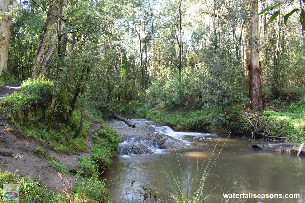
Horseshoe Falls is a cascade that runs over a mound of clay in the bed of Olinda Creek in Mount Evelyn. The pock-marked surface of the clay creates
a shimmering pattern on the water surface, with a dark muddy pool below.
 Above: Horseshoe Falls in Quinns Reserve, Mount Evelyn
(Order this image)
As far as waterfalls go, this one is vertically challenged, but there are still plenty of reasons why this is worth a visit. For those who live in the outer eastern suburbs of Melbourne, the walk to the falls is an easily accessible nature walk that is physically challenging for those wanting to get some moderate exercise.
The surrounding forest is dark with dense undergrowth, with the narrow track giving you a sense of being enclosed by nature. Olinda Creek can be
heard nearby, with the rush of Horseshoe Falls audible on a calm day from some distance away.
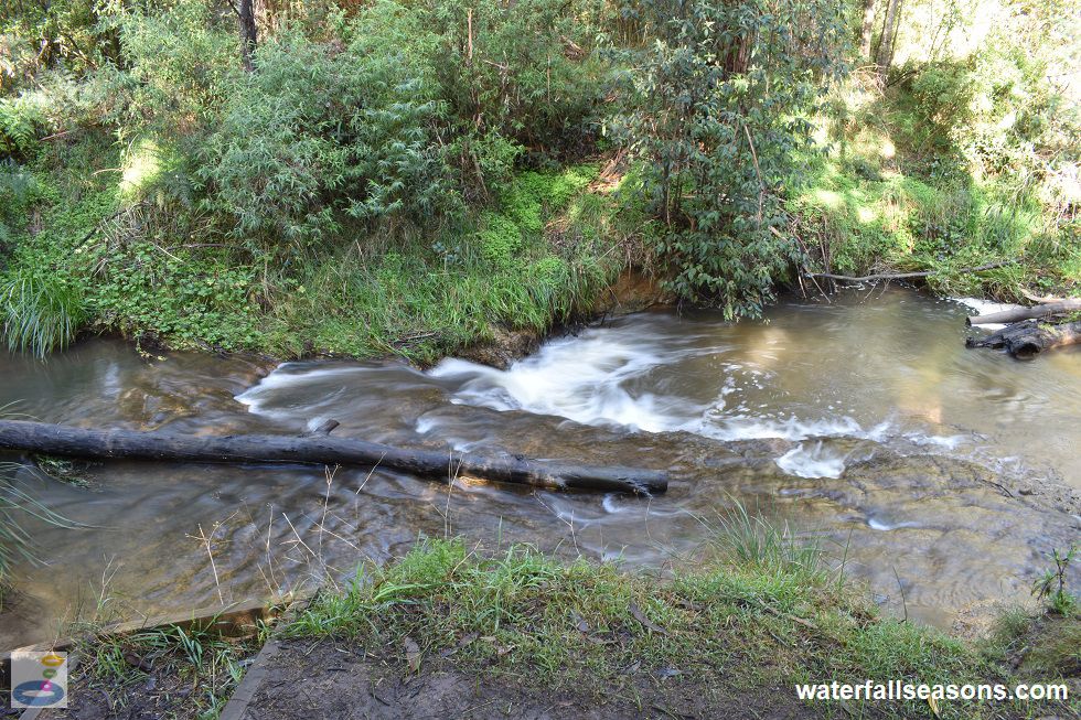
 Above: Horseshoe Falls from above the falls
(Order this image)
At the falls, there are some interesting historical markers. Right next to the falls, just near the little footbridge, is what looks like an Aboriginal canoe tree (it would be good if someone with more experience with Aboriginal cultural heritage could confirm that for me).
In the early 20th century, the falls were apparently the site of a water wheel that formed part of the
Cave Hill Tramway System that carted timber from the Dandenongs to the Cave Hill lime works
in Lilydale.
Here is a video of the falls, taken in early winter morning, when Olinda Creek was running well, but not in flood:
View Larger Map
 Above: Horseshoe Falls in Quinns Reserve, Mount Evelyn
(Order this image)
As far as waterfalls go, this one is vertically challenged, but there are still plenty of reasons why this is worth a visit. For those who live in the outer eastern suburbs of Melbourne, the walk to the falls is an easily accessible nature walk that is physically challenging for those wanting to get some moderate exercise.
 Above: Horseshoe Falls from above the falls
(Order this image)
At the falls, there are some interesting historical markers. Right next to the falls, just near the little footbridge, is what looks like an Aboriginal canoe tree (it would be good if someone with more experience with Aboriginal cultural heritage could confirm that for me).
Here is a video of the falls, taken in early winter morning, when Olinda Creek was running well, but not in flood:
Your Seasonal Guide:
| Best Time of Year to Visit: | Best Time of Day to Visit: |
|---|---|
| Reliable flow all year except during summer/autumn in drought years | Visit in the afternoon to see the falls in full sun |
Other Information Before You Go:
Location: Quinns Reserve, Mount Evelyn, 40 km east of the Melbourne CBD
Latitude:-37.793461 Longitude:145.367141
Getting there: The two shortest routes by foot are from the end of Railway Road (accessible from York Road (C402) via Falls Road in Mount Evelyn) or from the end of Blue Wren Court (accessible from Swansea Road (C401) via Marne Road). Blue Wren Court is paved, but Railway Road is gravel. Park in the space before or at the turning circles at the end of each road. It is a few hundred metre walk to the falls from either end.
Water source: Olinda Creek
Approx. height: 1 m Approx. width: 4 m
Approx. length: 2 m
Swimming available at the falls: I have read reports in the Victorian Heritage Database that people swam there in the 1920s and 1930s, but water quality in Olinda Creek is significantly poorer now due to agricultural and urban runoff upstream.
Facilities: None
Entrance fee: None
Opening times: Always open
Sun shade: Shade available along the track and at the falls
Wheelchair access: None
Prohibitions: No dogs, no cats, no trailbikes, no fires
Managing authority: Yarra Ranges Council in partnership with the Friends on the Water Race and Quinn Reserve.
Nearby attractions: Olinda Falls at the head of Olinda Creek up on Mount Dandenong, around 7 km to the south.
Before you head out, make sure to read the
waterfall safety information and check with the managing authority for any current change of conditions. The managing authority
advises that there may be snakes along the walking track.
Latitude:-37.793461 Longitude:145.367141
Getting there: The two shortest routes by foot are from the end of Railway Road (accessible from York Road (C402) via Falls Road in Mount Evelyn) or from the end of Blue Wren Court (accessible from Swansea Road (C401) via Marne Road). Blue Wren Court is paved, but Railway Road is gravel. Park in the space before or at the turning circles at the end of each road. It is a few hundred metre walk to the falls from either end.
Water source: Olinda Creek
Approx. height: 1 m Approx. width: 4 m
Approx. length: 2 m
Swimming available at the falls: I have read reports in the Victorian Heritage Database that people swam there in the 1920s and 1930s, but water quality in Olinda Creek is significantly poorer now due to agricultural and urban runoff upstream.
Facilities: None
Entrance fee: None
Opening times: Always open
Sun shade: Shade available along the track and at the falls
Wheelchair access: None
Prohibitions: No dogs, no cats, no trailbikes, no fires
Managing authority: Yarra Ranges Council in partnership with the Friends on the Water Race and Quinn Reserve.
Nearby attractions: Olinda Falls at the head of Olinda Creek up on Mount Dandenong, around 7 km to the south.
Locality Map:
The marker indicates the location of the falls. If the map is not zoomed in locally, as can occur with some browsers, simply refresh this web page.
View Larger Map
Comments:
If you would like to leave a comment about this waterfall, please fill in the comment box below.
I'm particularly interested in your experiences after visiting, and any changes in conditions, etc.
All fields are required if you would like to see your comments appear on this website.
| ← Back | Next Falls → |
| Victoria | Melbourne |
| Safety Info | Map |
| List of Lists | Your Support |
| Feedback | Media |
|
|
|
|
|
|
|
|
|
|
© Brad Neal 2024. All rights reserved. Here are my
affiliate links and cookies policy and opportunities to provide support to Waterfall Seasons.