| ← Back | Next Falls → |
Sabine Falls, VICWaterfall Seasons - The Waterfall Guide
| Australia |
| Victoria |
| Regions of Victoria: |
| Melbourne |
| Nth East VIC |
| Western VIC |
| Gippsland |
| Other Information: |
| Safety Info |
| Map |
| Your Support |
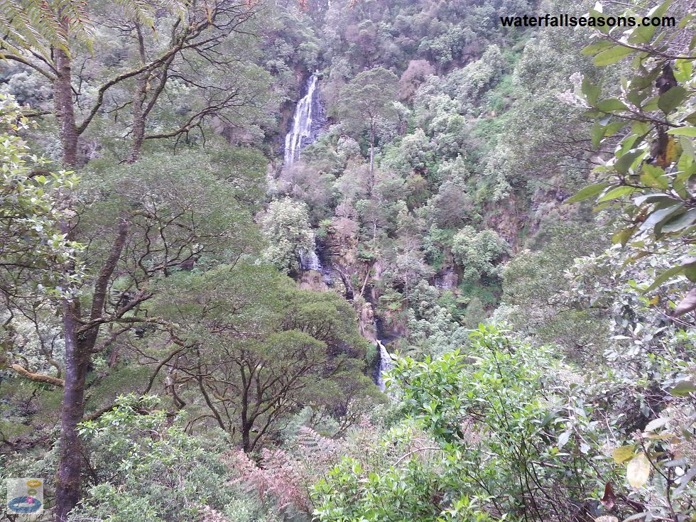
This is a waterfall for nature lovers, fitness fanatics and history buffs, but the waterfall itself remains somewhat at a distance,
even at the end of the walk. Bring a pair of binoculars in your backpack for this one to get the most of your visit. You can still
see and hear the waterfalls, but it is at a distance of several hundred metres on the other side of a ridiculously steep, thickly
vegetated valley. According to the managing authority, this is the tallest waterfall in the Otways.
 Above: The view of Sabine Falls
(Order this image)
The walk through lush rainforest is however very enjoyable, with sections of steep terrain, creek crossings and an old mill site. If you are looking for a walk to test your fitness without completely exhausting you, this could be it. The first two thirds of the walk are relatively flat, but with lots of natural obstacles such as fallen logs to climb over and under, and tree fern fronds to dodge and weave through.
The last third of the walk is very steep as you climb down into two gullies before rising again for the final stretch towards the falls.
Fortunately the track here has few obstacles, so it is really only a test of your fitness, rather than your agility here.
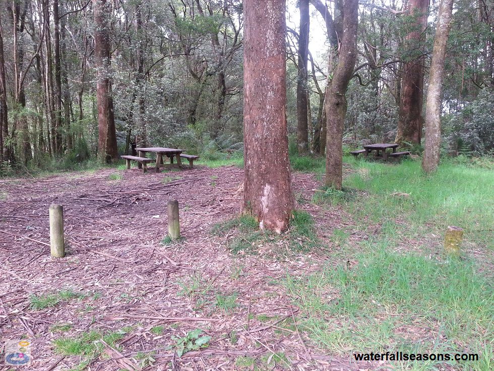
 Above: The picnic area at the Sabine Falls car park
(Order this image)
One spot to look out for is the old mill site, roughly half way along the track. There is no sign of the mill itself, but you can clearly see the rock cuttings that would have been used to channel the water that drove the mill.
Here is a video of the falls, taken on a sunny day in November after a relatively wet spring, when the falls were flowing well, which also gives you a good sense of what the walk is like:
View Larger Map
 Above: The view of Sabine Falls
(Order this image)
The walk through lush rainforest is however very enjoyable, with sections of steep terrain, creek crossings and an old mill site. If you are looking for a walk to test your fitness without completely exhausting you, this could be it. The first two thirds of the walk are relatively flat, but with lots of natural obstacles such as fallen logs to climb over and under, and tree fern fronds to dodge and weave through.
 Above: The picnic area at the Sabine Falls car park
(Order this image)
One spot to look out for is the old mill site, roughly half way along the track. There is no sign of the mill itself, but you can clearly see the rock cuttings that would have been used to channel the water that drove the mill.
Here is a video of the falls, taken on a sunny day in November after a relatively wet spring, when the falls were flowing well, which also gives you a good sense of what the walk is like:
Your Seasonal Guide:
| Best Time of Year to Visit: | Best Time of Day to Visit: |
|---|---|
| Visit on a dry day in late spring or early summer, when the falls will be flowing large and loud enough to take notice of, but when you won't have to contend with brushing off wet tree fern fronds or deep creek crossings | Visit near the middle of the day to allow the forest to dry out and to have the best chance of seeing sunlight on the falls |
Other Information Before You Go:
Location: Great Otway National Park, Sunnyside Road, Mount Sabine,
180 km south west of Melbourne (approx. 2.5 hr drive).
Latitude:-38.632765 Longitude:143.739418
Getting there: From Barramunga, head south for 10 km along the Forrest-Apollo Bay Road and turn left into Sunnyside Rd. Follow this road for 2.3 km, then turn right through the pine plantation. The picnic area is a further 1.4 km along this gravel road, that as suitable for 2WD vehicles at the time of my visit. The walk to the falls is approximately 3.6 km (up to 2.5 hrs) return from the car park.
Water source: Smythe Creek
Approx. height: 120 m of cascades Approx. width: 5-20 m
Approx. length: 180 m
Swimming available at the falls: No
Facilities: Car park, picnic tables, lawn area (overgrown at time of visit)
Entrance fee: None
Opening times: Always open
Sun shade: Shade available along most of the walk to the falls and at the viewing platform.
Wheelchair access: None
Prohibitions: No horseriding, no trail bikes, no dogs, fires may only be lit in fireplaces provided (none provided that I could see).
Managing authority: Parks Victoria
Nearby attractions: Stevensons Falls, 15 km to the north, or Marriners Falls, 40 km to the south, inland from Apollo Bay.
Before you head out, make sure to read the
waterfall safety information and check with the managing authority for any current change of conditions.
Latitude:-38.632765 Longitude:143.739418
Getting there: From Barramunga, head south for 10 km along the Forrest-Apollo Bay Road and turn left into Sunnyside Rd. Follow this road for 2.3 km, then turn right through the pine plantation. The picnic area is a further 1.4 km along this gravel road, that as suitable for 2WD vehicles at the time of my visit. The walk to the falls is approximately 3.6 km (up to 2.5 hrs) return from the car park.
Water source: Smythe Creek
Approx. height: 120 m of cascades Approx. width: 5-20 m
Approx. length: 180 m
Swimming available at the falls: No
Facilities: Car park, picnic tables, lawn area (overgrown at time of visit)
Entrance fee: None
Opening times: Always open
Sun shade: Shade available along most of the walk to the falls and at the viewing platform.
Wheelchair access: None
Prohibitions: No horseriding, no trail bikes, no dogs, fires may only be lit in fireplaces provided (none provided that I could see).
Managing authority: Parks Victoria
Nearby attractions: Stevensons Falls, 15 km to the north, or Marriners Falls, 40 km to the south, inland from Apollo Bay.
Locality Map:
The marker indicates the location of the car park and picnic area at the start of the walk to the falls. If the map is not zoomed in locally, as can occur with some browsers, simply refresh this web page.
View Larger Map
Comments:
If you would like to leave a comment about this waterfall, please fill in the comment box below.
I'm particularly interested in your experiences after visiting, and any changes in conditions, etc.
All fields are required if you would like to see your comments appear on this website.
| ← Back | Next Falls → |
| Victoria | Western VIC |
| Safety Info | Map |
| List of Lists | Your Support |
| Feedback | Media |
|
|
|
|
|
|
|
|
|
|
© Brad Neal 2024. All rights reserved. Here are my
affiliate links and cookies policy and opportunities to provide support to Waterfall Seasons.