| ← Home page | Next Falls → |
National Falls, Royal National Park, NSWWaterfall Seasons - The Waterfall Guide
To proclaim a waterfall as "National Falls" and name the nearest town nearby "Waterfall" implies these waterfalls are of national significance and therefore one of the best,
if not the best in Australia. Do these falls live up to this expectation?
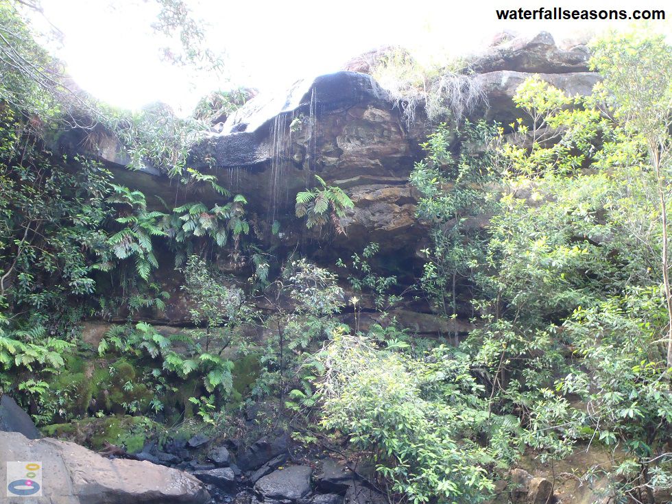
 Above: A section of National Falls
(Order this image)
Unfortunately not on my visit, when there was a mere trickle running over the falls despite the misty rain. Under these conditions it would be hard to claim that the falls would be of significance beyond the local area.
Although, in the land of droughts and flooding rains, an intermittent waterfall is very representative of what can be expected from most waterfalls across the country,
and this waterfall could maybe be claimed as illustrating the national character?
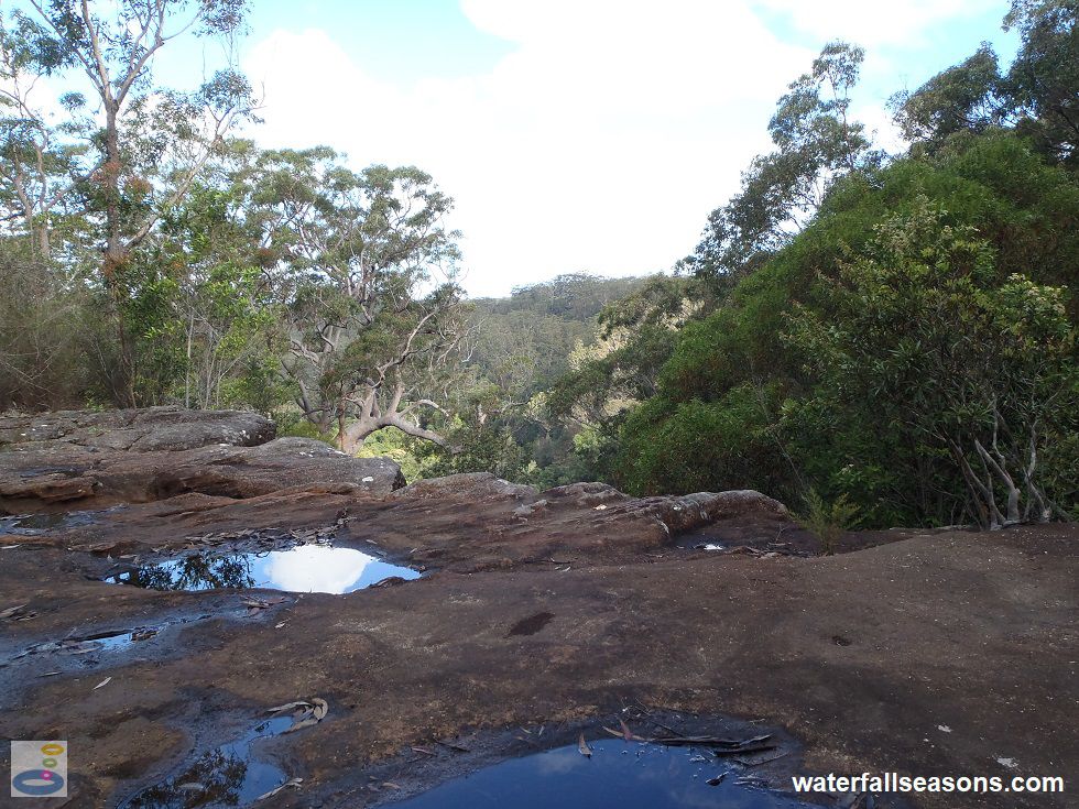
 Above: The view from above the top tier at National Falls
(Order this image)
The falls are in three main sections, with a sandstone shelf divided by tall vertical drops. There are two viewing areas, with some steps down to each. The lower section is inaccessible from these roadside viewing areas, which makes it a bit difficult to appreciate the full height of the falls.
If you are driving through the Royal National Park, the falls are worth a quick look
given their convenient location next to the road, particularly if it has been raining over recent days. However, lower your expectations and do not, like I did,
expect this to be a pilgrimage to a waterfall of unparalleled beauty in this nation. Hopefully I will change my opinion if I ever return during a wetter period.
View Larger Map
 Above: A section of National Falls
(Order this image)
Unfortunately not on my visit, when there was a mere trickle running over the falls despite the misty rain. Under these conditions it would be hard to claim that the falls would be of significance beyond the local area.
 Above: The view from above the top tier at National Falls
(Order this image)
The falls are in three main sections, with a sandstone shelf divided by tall vertical drops. There are two viewing areas, with some steps down to each. The lower section is inaccessible from these roadside viewing areas, which makes it a bit difficult to appreciate the full height of the falls.
Your Seasonal Guide:
| Best Time of Year to Visit: | Best Time of Day to Visit: |
|---|---|
| Visit after rainfall to see water flowing over the falls, as the creek can reduce to a trickle during dry periods | Visit in the morning to see the falls in full sunlight |
Other Information Before You Go:
Location: McKell Ave, Waterfall, Royal National Park, 48 km (approx. 1 hr 20 min drive) south of the Sydney CBD.
Latitude:-34.150815 Longitude:151.015075
Getting there: From the city head south along the Princes Hwy (A1/M1) to Waterfall. From Waterfall take McKell Ave for 3 km until you reach the falls. All roads were 2WD accessible on my visit.
Water source: Waterfall Creek
Approx. height: Very hard to judge for the whole falls because the drop beneath the lower tier is not visible, but the main visible drop looked like it was around 15-20 metres high.
Approx. width: 3-10 m, depending on flow conditions
Approx. length: Series of vertical drops over a length in excess of 100 metres
Swimming available at the falls: No
Facilities: Car park. There is a picnic area at Gunjulla Flat, 200 metres upstream of the falls, with picnic tables
Entrance fee: There is a nominal fee per vehicle for access to Royal National Park
Opening times: Open 7 am to 8.30 pm daily.
Sun shade: Shade available from the forest overhead
Wheelchair access: None
Prohibitions: No campfires, no solid fuel burners, no gathering firewood, no pets, no smoking, no littering, no camping, no bicycles
Managing authority: NSW National Parks and Wildlife Service
Nearby attractions: Wattamolla Falls and Toonoum Falls also in the Royal National Park
Before you head out, make sure to read the
waterfall safety information and check with the managing authority for any current change of conditions.
Latitude:-34.150815 Longitude:151.015075
Getting there: From the city head south along the Princes Hwy (A1/M1) to Waterfall. From Waterfall take McKell Ave for 3 km until you reach the falls. All roads were 2WD accessible on my visit.
Water source: Waterfall Creek
Approx. height: Very hard to judge for the whole falls because the drop beneath the lower tier is not visible, but the main visible drop looked like it was around 15-20 metres high.
Approx. width: 3-10 m, depending on flow conditions
Approx. length: Series of vertical drops over a length in excess of 100 metres
Swimming available at the falls: No
Facilities: Car park. There is a picnic area at Gunjulla Flat, 200 metres upstream of the falls, with picnic tables
Entrance fee: There is a nominal fee per vehicle for access to Royal National Park
Opening times: Open 7 am to 8.30 pm daily.
Sun shade: Shade available from the forest overhead
Wheelchair access: None
Prohibitions: No campfires, no solid fuel burners, no gathering firewood, no pets, no smoking, no littering, no camping, no bicycles
Managing authority: NSW National Parks and Wildlife Service
Nearby attractions: Wattamolla Falls and Toonoum Falls also in the Royal National Park
Locality Map:
The marker indicates the approximate location of the car park at the upper falls. If the map is not zoomed in locally, as can sometimes occur when loading, simply click or tap on "View Larger Map" below.
View Larger Map
Comments:
If you would like to leave a comment about this waterfall, please fill in the comment box below.
I'm particularly interested in your experiences after visiting, and any changes in conditions, etc.
All fields are required if you would like to see your comments on this website.
| ← Back | Next Falls → |
| Australia | NSW / ACT |
| Safety Info | Map |
| List of Lists | Your Support |
| Feedback | Media |
|
|
|
|
|
|
|
|
|
|
© Brad Neal 2024. All rights reserved. Here are my
affiliate links and cookies policy and opportunities to provide support to Waterfall Seasons.