| ← Back | Next Falls → |
Wentworth Falls, Blue Mountains, NSWWaterfall Seasons - The Waterfall Guide
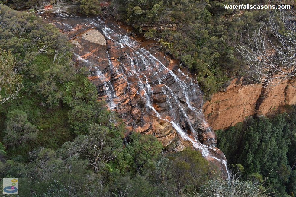
The perch above Wentworth Falls at Fletchers Lookout is one of the best panoramic views in the Blue Mountains, both horizontally and vertically, with the ground dropping
away on three sides and the waterfall disappearing down into the valley below. Refocus your gaze outwards and the horizon extends out into the Blue Mountains as far as you can see.
 Above: Wentworth Falls from Fletchers Lookout
(Order this image)
Accessing Wentworth Falls involves a bit of walking and some good timing. You cannot see the falls from the car park, and instead have to walk around 300 metres alongside the road to the Wentworth Falls Lookout and the start of the main walking track to the falls.
The track to the top section of the falls is fairly straight forward with a wide open track with sections of steps.
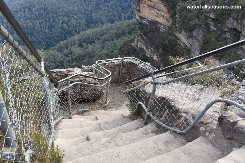
 Above: The last few steps down to Fletchers Lookout
(Order this image)
At Fletchers Lookout, you have to cross the creek using some concrete stepping stones that are very easy to step across as long as the water level is not too high.
On my visit the falls were flowing well, but not in flood, with plenty of freeboard above the creek water level to
the top of the steps. When the creek is in flood, these stepping stones would not be traversable, and you would have to stop at Fletchers Lookout.
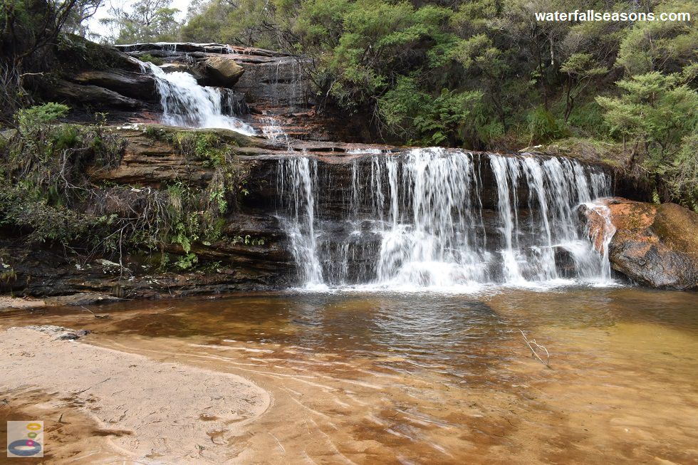
 Above: The uppermost section of Wentworth Falls from the stepping stones across the river
(Order this image)
After crossing the creek, the walk continues on to a lookout on the opposite side of the creek, followed by a steep descent down to the base of the falls at the valley floor. My visit was late in the day and I had some exhausted family members waiting back at the car park for me, so I was not able to head down to the valley floor and cannot report on the views there.
View Larger Map
 Above: Wentworth Falls from Fletchers Lookout
(Order this image)
Accessing Wentworth Falls involves a bit of walking and some good timing. You cannot see the falls from the car park, and instead have to walk around 300 metres alongside the road to the Wentworth Falls Lookout and the start of the main walking track to the falls.
 Above: The last few steps down to Fletchers Lookout
(Order this image)
At Fletchers Lookout, you have to cross the creek using some concrete stepping stones that are very easy to step across as long as the water level is not too high.
 Above: The uppermost section of Wentworth Falls from the stepping stones across the river
(Order this image)
After crossing the creek, the walk continues on to a lookout on the opposite side of the creek, followed by a steep descent down to the base of the falls at the valley floor. My visit was late in the day and I had some exhausted family members waiting back at the car park for me, so I was not able to head down to the valley floor and cannot report on the views there.
Your Seasonal Guide:
| Best Time of Year to Visit: | Best Time of Day to Visit: |
|---|---|
| You can see water flowing over the falls most of the time, with November to February typically the wettest months in the Blue Mountains | It is not possible to cross Jamison Creek to the base of the falls when the creek is in flood. Otherwise, any time is fine but you can avoid looking into the sun at the falls from early to mid afternoon |
Other Information Before You Go:
Location: Wentworth Falls Picnic Area, Sir H Burrell Drive, Wentworth Falls, Blue Mountains National Park, 100 km (approx. 1 hr 20 min drive) west of the Sydney CBD.
Latitude:-33.725496 Longitude:150.368733
Getting there: From the city head west along the Western Motorway (M4, includes tolls) which then becomes the Great Western Hwy (A32) as the road winds its way up the Blue Mountains. From the town of Wentworth Falls, follow Falls Road to the end until you reach the car park at the falls. It is a 300 metre walk from the car park along Sir H Burrell Drive to the viewing platform and the start of the main access track to the falls.
Water source: Jamison Creek
Approx. height: 200 metres
Approx. width: 20-30 m
Approx. length: 100 m, with around a 30 m long flat shelf separating the small upper section from the main drop
Swimming available at the falls: Apparently you can swim at the base of the falls, but I have not swum here
Facilities: At the top of the falls, there is a picnic area with picnic tables, public toilets, public barbecues, drinking taps, car park, and a viewing platform. There are no facilities at the base of the falls.
Entrance fee: None
Opening times: Always open, noting the track to the base of the falls can be inaccessible when Jamison Creek is in flood.
Sun shade: Shade available at the picnic area and along the walk, but with some areas of the track and the lookouts exposed to direct sunlight.
Wheelchair access: None to the falls. The lookouts at the car park and along Sir H Burrell Drive are wheelchair accessible.
Prohibitions: No pets, no smoking, no drones.
Managing authority: NSW National Parks and Wildlife Service
Nearby attractions: Katoomba Falls, 10 km to the west
Before you head out, make sure to read the
waterfall safety information and check with the managing authority for any current change of conditions. Specific to Wentworth Falls
there is one creek crossing that should not be crossed when the steppping stones are submerged.
Latitude:-33.725496 Longitude:150.368733
Getting there: From the city head west along the Western Motorway (M4, includes tolls) which then becomes the Great Western Hwy (A32) as the road winds its way up the Blue Mountains. From the town of Wentworth Falls, follow Falls Road to the end until you reach the car park at the falls. It is a 300 metre walk from the car park along Sir H Burrell Drive to the viewing platform and the start of the main access track to the falls.
Water source: Jamison Creek
Approx. height: 200 metres
Approx. width: 20-30 m
Approx. length: 100 m, with around a 30 m long flat shelf separating the small upper section from the main drop
Swimming available at the falls: Apparently you can swim at the base of the falls, but I have not swum here
Facilities: At the top of the falls, there is a picnic area with picnic tables, public toilets, public barbecues, drinking taps, car park, and a viewing platform. There are no facilities at the base of the falls.
Entrance fee: None
Opening times: Always open, noting the track to the base of the falls can be inaccessible when Jamison Creek is in flood.
Sun shade: Shade available at the picnic area and along the walk, but with some areas of the track and the lookouts exposed to direct sunlight.
Wheelchair access: None to the falls. The lookouts at the car park and along Sir H Burrell Drive are wheelchair accessible.
Prohibitions: No pets, no smoking, no drones.
Managing authority: NSW National Parks and Wildlife Service
Nearby attractions: Katoomba Falls, 10 km to the west
Locality Map:
The marker indicates the approximate location of the falls, including the distance from the car park. If the map is not zoomed in locally, as can sometimes occur when loading, simply click or tap on "View Larger Map" below.
View Larger Map
Comments:
If you would like to leave a comment about this waterfall, please fill in the comment box below.
I'm particularly interested in your experiences after visiting, and any changes in conditions, etc.
All fields are required if you would like to see your comments on this website.
| ← Back | Next Falls → |
| Australia | NSW / ACT |
| Safety Info | Map |
| List of Lists | Your Support |
| Feedback | Media |
|
|
|
|
|
|
|
|
|
|
© Brad Neal 2024. All rights reserved. Here are my
affiliate links and cookies policy and opportunities to provide support to Waterfall Seasons.