| ← Back | Next Falls → |
Gardners FallsWaterfall Seasons - The Waterfall Guide
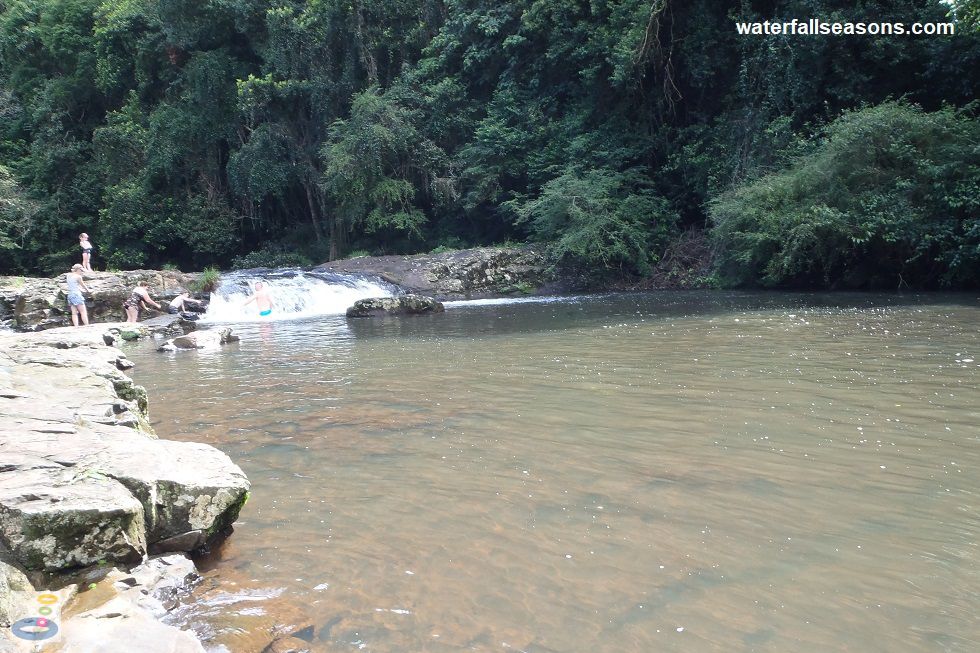
Gardners Falls consists of two short drops, separated by a 40 metre long flat shelf in between. The upper section of the falls is less than two metres high,
but because it is less ferocious than the main drop, with shallow water immediately downstream, it is popular for clambering over when the water flow is not
too strong.
 Above: The smaller, upper section of Gardners Falls
(Order this image)
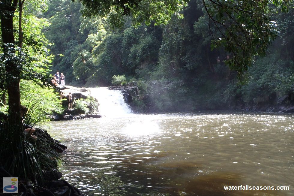
The main drop downstream is more than twice as high, at around five metres at its highest point. Here the wide stream is channelled into a narrow gap before rushing down the rock face into a wide, deep pool below.
The dry rockshelf that runs alongside the stretch of the creek between the upper and lower tier is a good spot to listen to the waterfall in stereo, with the sounds from one tier in your
left ear, and the sounds from the other tier in your right ear downstream. There is a rough and sometimes slippery path that runs around the edge of the pool, for viewing the falls from downstream.
 Above: The main drop at Gardners Falls
(Order this image)
Getting to the falls from the car park is quite easy along a wide and well maintained path that is cleared of vegetation on either side. The path runs along the creek upstream of the falls. Parking here is on a steep slope, with limited spots available, so if it is busy you might need to park further up the hill and walk down to the start of the walk.
View Larger Map
 Above: The smaller, upper section of Gardners Falls
(Order this image)
The main drop downstream is more than twice as high, at around five metres at its highest point. Here the wide stream is channelled into a narrow gap before rushing down the rock face into a wide, deep pool below.
 Above: The main drop at Gardners Falls
(Order this image)
Getting to the falls from the car park is quite easy along a wide and well maintained path that is cleared of vegetation on either side. The path runs along the creek upstream of the falls. Parking here is on a steep slope, with limited spots available, so if it is busy you might need to park further up the hill and walk down to the start of the walk.
Your Seasonal Guide:
| Best Time of Year to Visit: | Best Time of Day to Visit: |
|---|---|
| The flow over the falls is usually reliable at any time of year, but the falls have been reduced to a trickle in past dry years in some summer months | Visit close to the middle of the day to see the falls in full sun |
Other Information Before You Go:
Location: At the end of Obi Lane South in Maleny.
Latitude:-26.759895 Longitude:152.873931
Getting there: From Steve Irwin Way at Landsborough, head up Maleny St which becomes the Landsborough Maleny Road (Route 23) and follow it for 12 km until you see the sign for Gardners Falls at Obi Lane South. The car park is at the end of Obi Lane South, about 1 km from Route 23. To reach the waterfall, walk about 300 metres along the path to the falls. The drive up to this spot from Landsborough is quite impressive, with panoramic views on both sides of the road.
Water source: Obi Obi Creek
Approx. height: 5 metres on the main tier
Approx. width: 4 metres on the main tier
Approx. length: 3 metres on the main tier
Swimming available at the falls: Yes, see my swim here
Facilities: Public toilets, picnic tables, car park, rubbish bins
Entrance fee: None
Opening times: Always open
Sun shade: Shade available near the falls, but much of the picnic area is not in shade for most of the day.
Wheelchair access: There are wheelchair accessible paths to the open area upstream of the falls, but no access to the falls or the pool at the base of the falls.
Prohibitions including whether you can bring your dog: No diving, no caravans, no fires, no overnight stays (RVs), no camping, no dogs.
Managing authority: Sunshine Coast Council
Nearby attractions: Mary Cairncross Scenic Reserve, 3 km south of the falls
Before you head out, make sure you read the
waterfall safety information and check with the managing authority for any current change of conditions.
Specific to this site, the managing authority warns swimmers to beware of submerged rocks and
broken glass, and to swim with caution. Diving into the water is prohibited. The managing authority also recommends that you do not leave any valuables in
your car.
Latitude:-26.759895 Longitude:152.873931
Getting there: From Steve Irwin Way at Landsborough, head up Maleny St which becomes the Landsborough Maleny Road (Route 23) and follow it for 12 km until you see the sign for Gardners Falls at Obi Lane South. The car park is at the end of Obi Lane South, about 1 km from Route 23. To reach the waterfall, walk about 300 metres along the path to the falls. The drive up to this spot from Landsborough is quite impressive, with panoramic views on both sides of the road.
Water source: Obi Obi Creek
Approx. height: 5 metres on the main tier
Approx. width: 4 metres on the main tier
Approx. length: 3 metres on the main tier
Swimming available at the falls: Yes, see my swim here
Facilities: Public toilets, picnic tables, car park, rubbish bins
Entrance fee: None
Opening times: Always open
Sun shade: Shade available near the falls, but much of the picnic area is not in shade for most of the day.
Wheelchair access: There are wheelchair accessible paths to the open area upstream of the falls, but no access to the falls or the pool at the base of the falls.
Prohibitions including whether you can bring your dog: No diving, no caravans, no fires, no overnight stays (RVs), no camping, no dogs.
Managing authority: Sunshine Coast Council
Nearby attractions: Mary Cairncross Scenic Reserve, 3 km south of the falls
Locality Map:
The marker indicates the approximate location of the car park at the start of the walk to the falls. If the map is not zoomed in locally, as can occur with some browsers, simply refresh this web page.
View Larger Map
Comments:
If you would like to leave a comment about this waterfall, please fill in the comment box below.
I'm particularly interested in your experiences after visiting, and any changes in conditions, etc.
All fields are required if you would like to see your comments appear on this website.
| ← Back | Next Falls → |
| Australia | Queensland |
| Safety Info | Map |
| List of Lists | Your Support |
| Feedback | Media |
|
|
|
|
|
|
|
|
|
|
© Brad Neal 2024. All rights reserved. Here are my
affiliate links and cookies policy and opportunities to provide support to Waterfall Seasons.